Using GIS techniques as valuable tools for the cartographic representation of geosites in the Massif des Bauges UNESCO Global Geopark
Utilisation des techniques SIG comme outils précieux pour la représentation cartographique des géosites dans le Géoparc mondial de l'UNESCO du Massif des Bauges
Résumé
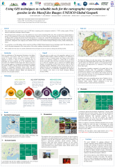
This poster presents work carried out as part of a PhD thesis comparing geosites management methods in 2 UGG working together: M’Goun (Morocco) and Massif des Bauges (France) Geoparks.The ongoing inventory of geosites is one of the conditions for success and for maintaining UGG status. How to integrate ongoing addition of geosites to the management of the geosites collection grounding a Geopark is the stake of the study, analysing first the strategy used by the Massif des Bauges UGG to manage the increase from 50 initial geosites to 73 current ones. Using GIS and implementing a new database is the solution explored, allowing to create new types of maps and integrate in the database various pertinent details such as the date of selection, site classification, management tools employed, and evaluation scores based on the National Geological Heritage Inventory (INPG) methodology in France.In a second time, a new GIS database will be created for the M'Goun UNESCO Geopark, based on the Bauges model. This database will be used for the proper management of the various geosites of the territory (updating, characterization, information). This example shows the interest of scientific collaboration between Geoparks in terms of experience sharing and technology transfer.
Fichier principal
 Poster of KOTTABi Salah Eddine_Using GIS techniques as valuable tools for the cartographic representation of geosites in the Massif des Bauges UNESCO Global Geopark.pdf (2.72 Mo)
Télécharger le fichier
Poster of KOTTABi Salah Eddine_Using GIS techniques as valuable tools for the cartographic representation of geosites in the Massif des Bauges UNESCO Global Geopark.pdf (2.72 Mo)
Télécharger le fichier
Origine : Fichiers produits par l'(les) auteur(s)